Tuesday, August 18, 2015

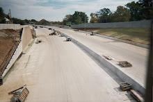
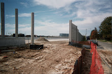
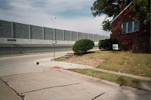
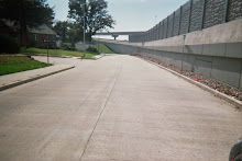
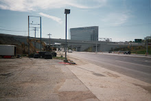
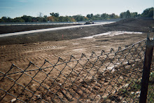
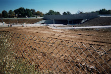
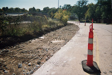
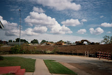
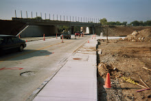
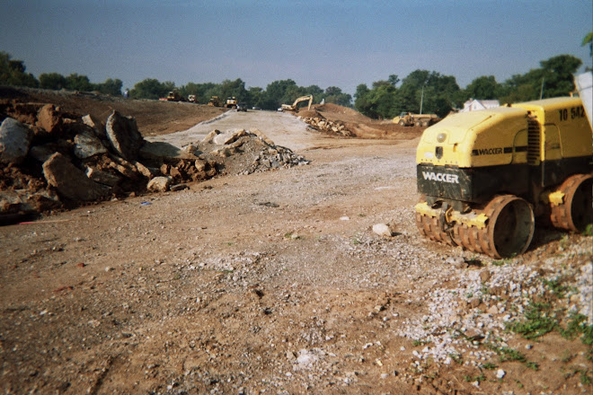
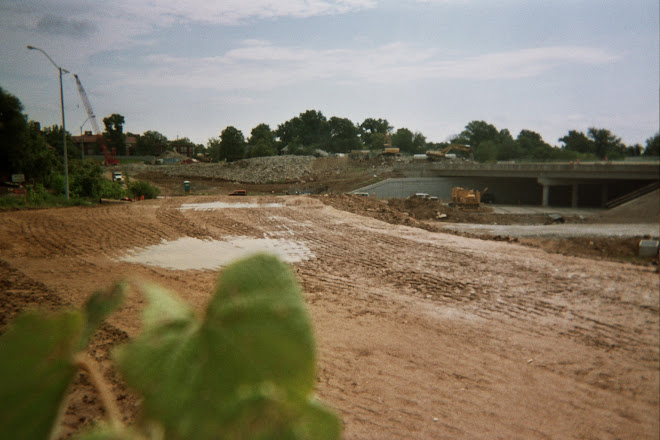
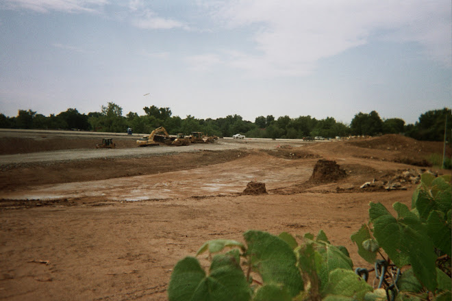
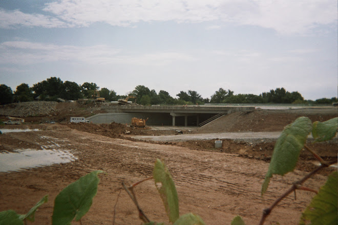
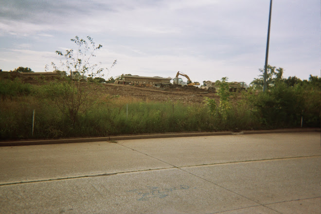
Oakland Avenue at Clayton Avenue, intersecting Hampton Avenue, near the New I-64 Hwy., showing the area for the St. Louis Zoo Expansion


Area left from the demolished Deaconess Hospital (Forest Park Hospital, more recently).  See:  http://directoryofstlouis.com/blog/st-louis-zoo-finds-elbow-room-at-old-deaconess/


The Imo's Restaurant island area in the middle of Oakland Avenue, Clayton Avenue and Hampton Avenue


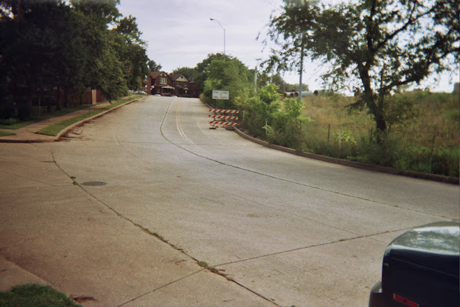
Looking north on Hampton Avenue, toward Forest Park, and both Clayton Avenue and Oakland Avenue intersecting, at the New I-64 Hwy.


Mercedes-Benz of St. Louis auto dealership, and the Imo's Pizza restaurant, on the east side of Hampton Avenue

Tuesday, August 11, 2015

PEDESTRIAN ACCESS TO AND AROUND FOREST PARK - Oakland Avenue from McCausland Avenue/Clayton Road/Clayton Avenue/Skinker Blvd. intersection east, toward the St. Louis Zoo new expansion

 Oakland Avenue's new tan pebbled concrete sidewalks, standard white concrete curbs and black asphalt pavement with white striping for a wide bicycle lane, completed this summer, 2015

 New sidewalks still being completed, at the Oakland Avenue/Clayton Road/Clayton Avenue/McCausland Avenue intersection, near Forest Park

 New concrete forms still existing, looking toward Forest Park and Skinker Blvd.


 At the Hi-Pointe Theatre, concrete installed with the ADA/handicapped strip at the street edge

 From the Amoco gas station property, looking east down Oakland Avenue, showing the new street lighting, stop signs, sidewalks and curbs and ADA strips

 Looking at the Hi-Pointe Theatre property, new concrete around the entrance

 The new concrete design - brick pattern in a gray-colored concrete at the curb, and white standard concrete with curb

New concrete at the Hi-Pointe Theatre

Pictures from Around the Neighborhood - Blendon Place, Oakland Avenue, Wise Avenue, Yale Avenue, Berthold Avenue, Hi-Pointe Place, Kuhs Place, Ethel Avenue, Highland Terrace, Clayton Road, McCausland Avenue, at the New I-64 Highway

 Oakland Avenue apartments, located at Blendon Place

 Oakland Avenue new condominiums, fronting on Clayton Road, also

 Oakland Avenue, looking east

 Oakland Avenue, looking west, taken from near Blendon Place

 Kuhs Place, looking toward Ethel Avenue, from at the Oakland Avenue intersection

 Hi-Pointe Place, looking toward Ethel Avenue

 Oakland Avenue, looking east, from the Hi-Pointe Place intersection

 Oakland Avenue, looking west, from the Hi-Pointe Place intersection

 Hi-Pointe Place, looking toward Oakland Avenue

 McCausland Avenue and Ethel Avenue houses, from the Hi-Pointe Place intersection

 Hi-Pointe Place, looking toward Oakland Avenue, from the Ethel Avenue intersection

 Houses on Berthold Avenue

 Old and existing Berthold Avenue intersection, looking east toward McCausland Avenue, and the New I-64 Highway.

 Missouri Dept. of Transportation property around the old and existing Berthold Avenue

 Berthold Avenue's old end of the street (existed prior to the highway 40/64 construction in the 1960s), showing the city of St. Louis Land Reclamation Authority property

 Wise Avenue, looking toward Bellevue Avenue, from the Berthold Avenue intersection

 Berthold Avenue curving up the hill, with Blendon Place on the left

 Wise Avenue, with Berthold Avenue at the end of the street

 Yale Avenue, looking toward Oakland Avenue

 Oakland Avenue looking east

Yale Avenue, looking toward the Wise Avenue intersection

 Blendon Place, looking toward Oakland Avenue

 Blendon Place, looking toward Berthold Avenue, with the Ethel Avenue intersection on the left side

 Kuhs Place, looking toward Oakland Avenue, from at the Ethel Avenue intersection

 Ethel Avenue, looking west from the Hi-Pointe Place intersection

 Wise Avenue new concrete road and sidewalks, new sod laid - finished on the east side of Bellevue Avenue


 Concrete road work - replacing Wise Avenue ongoing this summer

Wise Avenue at Highland Terrace intersection

Monday, August 10, 2015

Urban Trails


North St. Louis County in December, 2014.  See the cake?  This river property was the site of an early landing, for settlers who came by water, and camped.


Forest Park in the city of St. Louis, Washington University neighborhood, with the golf course carts roadway and the dual trail walking trail, in Summer, 2015.


Historical house and property with surrounding land and walks, in 2014.  See the cake?  St. Louis celebrated 250 years in February, 2014, continued through February, 2015.


St. Louis Botanical Garden Children's Garden  -  two bridge walkways, from 2014.  Botanical Garden is located near Kingshighway Blvd., near Highway 44, and adjacent to Tower Grove Park.  Have you seen the Shaw Nature Reserve, part of the Botanical Garden?   This rural area is located in Franklin County, Missouri - southwest of St. Louis, down Highway 44.

Tuesday, April 21, 2015

New improvements coming


Part of a drawing, dated November 21, 2001, submitted with recommendations for The New I-64 Hwy. McCausland Ave./Skinker Blvd./Clayton Road/Clayton Avenue/Oakland Avenue intersection, just north of Hwy. I-64, in the Washington University neighborhood.  This drawing included a new gas station, to be located in the lower left corner, of this drawing.  The built Hwy. I-64 eliminated the ramp that is visible in the middle-right hand side of this drawing.  Sidewalk improvements are, just now, being constructed.  The striping is coming.  New "walk" signs are being put in place at corners of the Clayton Road/Skinker Blvd. to McCausland Ave. intersection.  The importance of McCausland Avenue is not evident in this drawing - McCausland Avenue is the only way onto east or westbound Hwy. I-64 here, now. 

Monday, January 26, 2015

Intersection at Clayton Road and McCausland Avenue to be improved, starting Summer 2015

According to the West End Word newspaper, January 16-29 issue, on page 4:  "$2 Million Project To Improve Forest Park Access", there will be construction starting this year on the McCausland Avenue./Skinker Blvd. side of Forest Park.  This will include bike lanes, sidewalks, traffic signals, curb ramps and crosswalks, and a dual lane trail.  The construction will go east, to Hampton Avenue, where the new St. Louis Zoo expansion construction is underway.  Louisville Avenue and Tamm Avenue, on the south side of Forest Park, between Hampton Avenue and McCausland Avenue/Skinker Blvd., will have improved access to the Park.  The improvements are scheduled to be done by early 2016.

I drew up plans for the Skinker Blvd./McCausland Avenue intersection in 2001, when working with the Missouri Dept. of Transportation and the three committees who were working as advisors to state highway officials on rebuilding Highway 40 - a project called "The New I-64".  These three committees omitted the area between McCausland Avenue and Bellevue Avenue, which is where I live, and where the city of St. Louis/Richmond Heights line exists, just south of the city of Clayton line, at Clayton Road.  Their three committees included the areas of:  segment from Tower Grove to McCausland Avenue;  segment from Bellevue Avenue to Brentwood Blvd;  segment from McKnight Road to Spoede Road.  Not incidentally, I lived in the area omitted between Brentwood Blvd. and McKnight Road, also, between 1985-1988, in Richmond Heights and Brentwood.  Both of those addresses have been torn down.  I documented this in a project around 2003, 2004, 2005, and into 2012, when a business at the intersection of Brentwood Blvd. and Eager Road (east side of Brentwood Blvd.) was torn down, to make way for the new Drury Inn.  The new Brentwood Square expansion occurred around 2004-2005, and the highway expansion, before 2009, brought the razing of the apartment buildings located north of Brentwood Forest Condominiums, along the highway.


Thursday, February 18, 2010

National Engineers Week, February 14 - 20, 2010

Introduce a Girl to Engineering Day, February 18, 2010 - see:
http://www.eweek.org/EngineersWeek/Introduce.aspx

A Sightseer's Guide to Engineering webpage, see:
http://www.engineeringsights.org/

Other information, see:
http://www.eweek.org

Home Builders Association of St. Louis and Eastern Missouri, see: http://www.stlhba.com/consumer/links

Mr. Mark Thomas Morley, board member of the Home Builders Association, and "once President of one of the area's largest home builders", according to the St. Louis Post-Dispatch newspaper, www.stltoday.com/obits,
died on February 16, 2010, at age 48 years, of cancer.

Mr. John A. Shiell, "Longtime president of Lindell Trust Co." (now Lindell Bank), who built a bank branch "near the city limit at Hi-Pointe to serve suburban customers", according to his obituary in the St. Louis Post-Dispatch on February 17, 2010, died at age 90 years, on February 14, 2010. This bank is within walking distance of where I live, and in the city of St. Louis Hi-Pointe neighborhood, near the Hi-Pointe Theatre.

General Motors has an Assembly Plant located in Wentzville, Missouri, where I am from, in St. Charles County.

General Motors Corporate Policy regarding plant tours and political contributions, see: http://www.gm.com/corporate/investor_information/docs/corp_gov/GMPolicyCorporatePoliticalContributionsandExpenditures.pdf

Bowling Green Assembly Plant - Home of the Corvette, see:
http://www.bowlinggreenassemblyplant.com/

GM Powertrain - Performance Build Center in Wixom, Michigan, is open for tours, see: http://www.gm.com/experience/technology/gmpowertrain/pbc/tours/pbc_map_directions.jsp

Monday, February 8, 2010

2010 counting down - 10 months, 20 days left

Everybody counts!

See video postings regarding the U.S. Census 2010 at this website:

http://www.youtube.com/user/uscensusbureau

Videos posted

See videos regarding the Party on the Highway and The New I-64:

http://www.youtube.com/user/modotvideo#p/u/15/vzBAl2OpePo

Tuesday, January 19, 2010

Hi-Pointe Neighborhood Update, with the city of Richmond Heights

The sound walls are up on the new Highway 64, and the sound has decreased coming into this neighborhood. This is the first noticeable fact, and the most important one, about the new highway construction. I'm glad they got a sound wall on both sides for the full length of the project.

There is a HNTB vehicle parked on property at 1128 Blendon Place, on the sidewalk of that property, today. So, there's some interest on finishing Berthold Avenue.

The St. Louis Post-Dispatch carried an article on the front page, entitled "Boxed in by Highway 40", about this Hi-Pointe neighborhood, in the city of St. Louis, on January 11, 2010. The article had two big pictures of the end of Berthold Avenue, at McCausland Avenue. The Mo. Dept. of Transportation has proposed a cul-de-sac for the top of the hill on Berthold Avenue, cutting off access to McCausland Avenue. See: www.stltoday.com.

In graphic concept drawings, I never proposed cutting off Berthold Avenue from McCausland Avenue, but made other proposals to develop the area, grass and tear down, and create more parking spaces. I ran out of money, and used what I had, and was told by MoDOT to continue working on my proposals, with the St. Louis Development Corporation.
My major concern is parking. There needs to be more parking space on Blendon Place. There's no access to the rear of some properties on the east side of that street. There's no parking for properties facing McCausland Avenue on McCausland Avenue, and they must park in the rear of their properties and not block the alley. Also, the alley they use has the only access to the alley behind properties facing Berthold Avenue. The alleyway going from Ethel Avenue, behind properties on Blendon Place, is blocked by weed, young trees growth, and is not maintained as a traffic thru-way. I don't know why that is, but that needs to be changed.

The 20 year old signs on Blendon Place, that state '1 Hour Parking' are still standing, and are not enforced because there would be no one who would want to or could live here that way. Why are they even there?

The article states that some are driving illegally through the area. Well, let me tell you, there's nothing new about people driving illegally through the area.

This article does little but put an OK on what MoDOT has planned for the area.

In regards to new ownership here - I have noticed that owners have sold and resold their properties to themselves, or to another entity within their family or business, in order to increase the worth of the property. This has nothing to do with the amount of taxes to be placed on property. This has a lot to do with resale value, and with rental amounts, and the ability to rent and/or sell. Taxes are of little concern, since there will always be taxes.

I need money. I'm interested in codes, especially building codes, and the inspection process, following renovation or construction. Parking spaces are allocated to homes and businesses according to code. Notice, that this area situated in the St. Louis area - how could anyone who works in the same business that I do not recognize any of the problems here before I ever moved in and did, starting in 1996? There has been new construction here.

There are bankruptcies and divorces. I see dogs, as if these were a common household members.

The Party on the Highway went well, on opening day, in December. I went there, and had a good time, but that's right outside my door, and just walked or biked over there.